| |
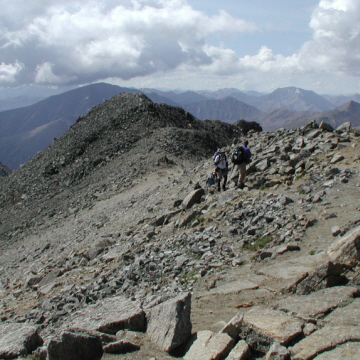
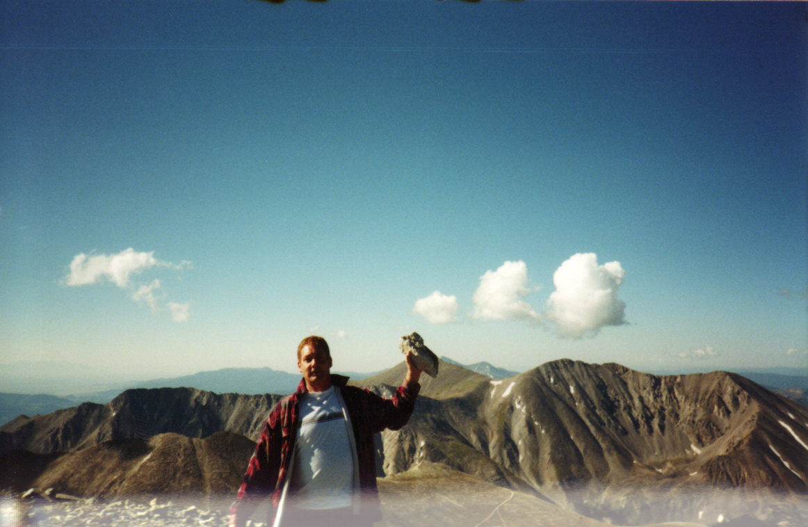
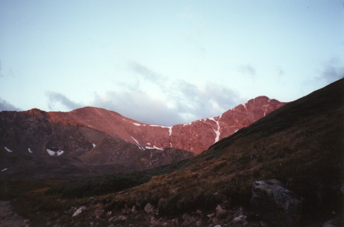
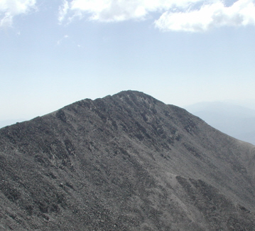
#1 Mt Elbert - 14,433 ft - Class 1 - 8/4/01 |
|
| |
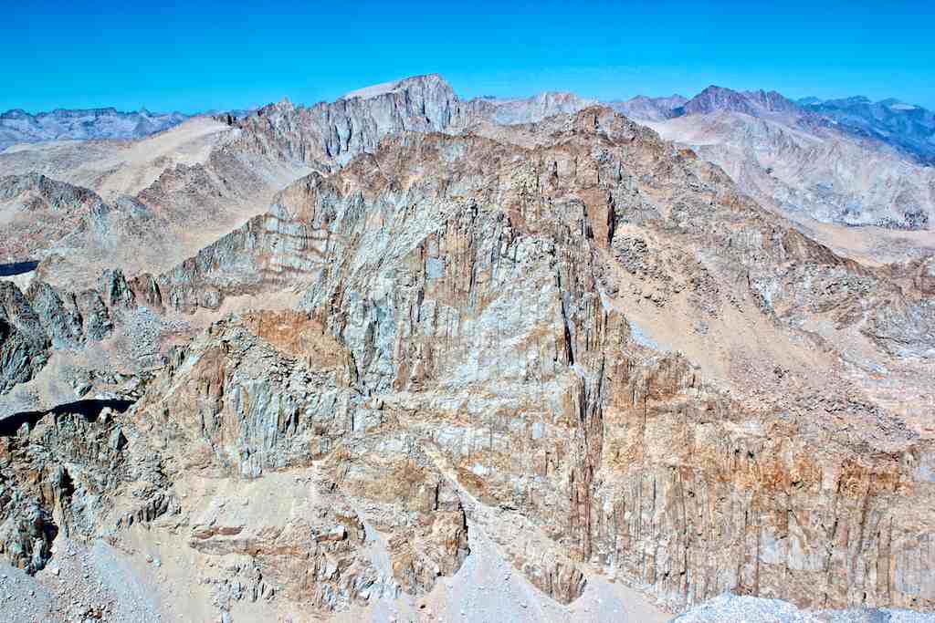
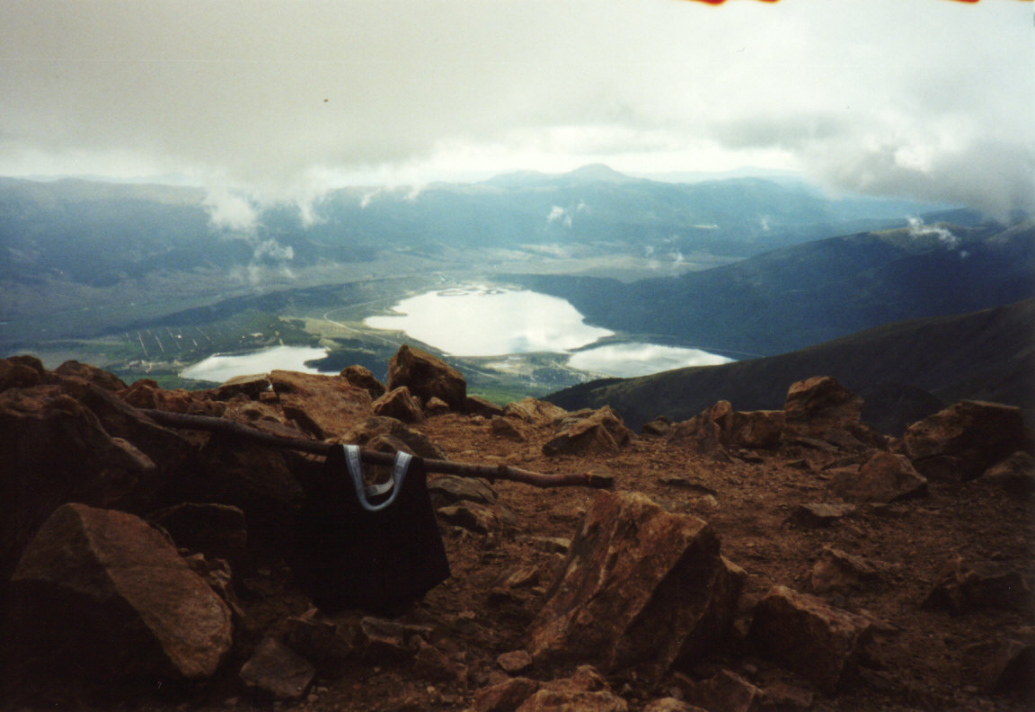
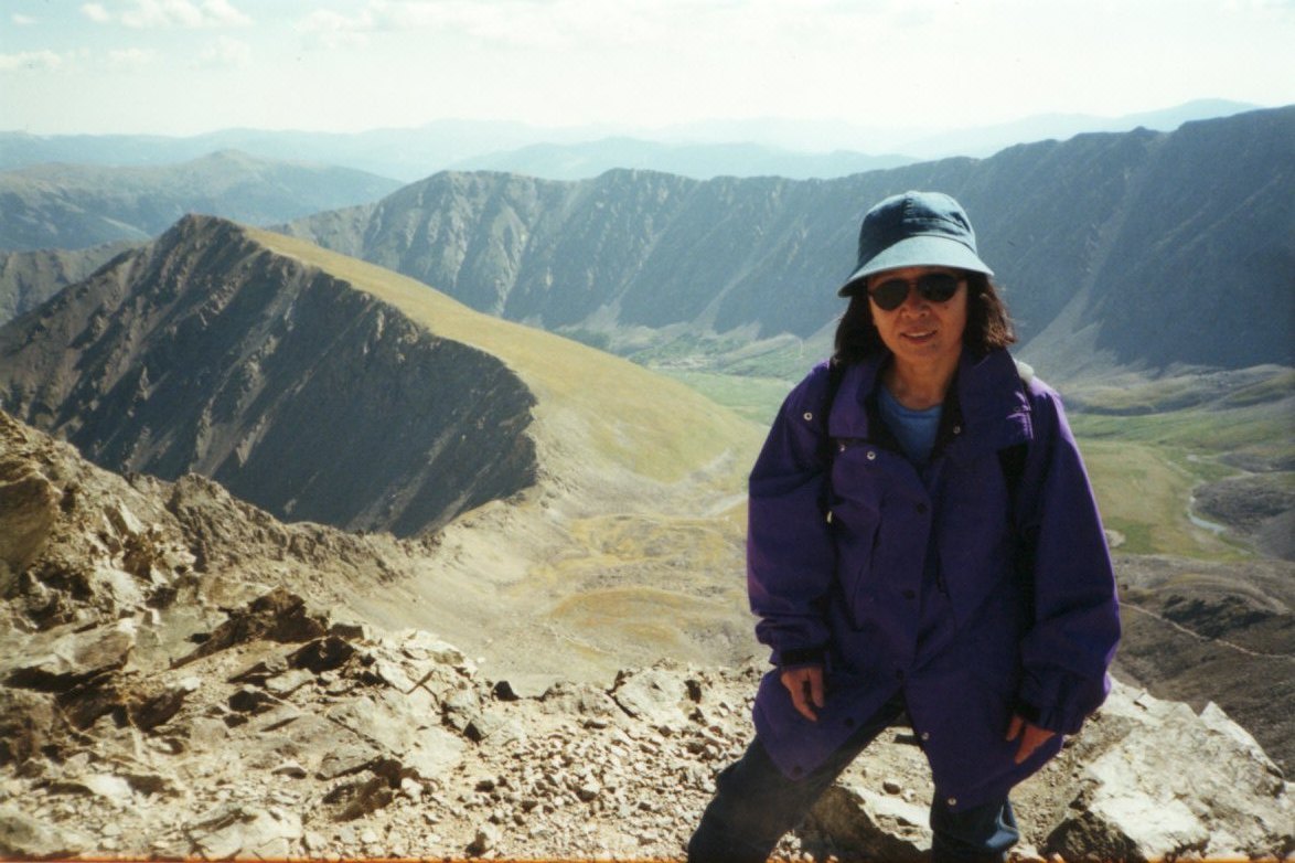
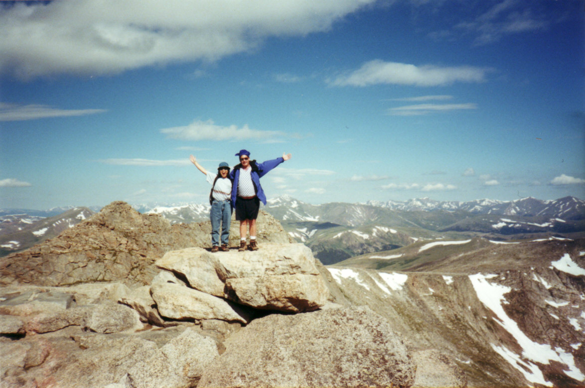
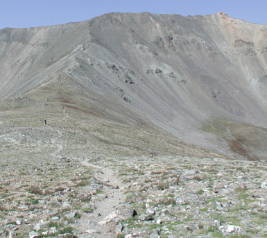
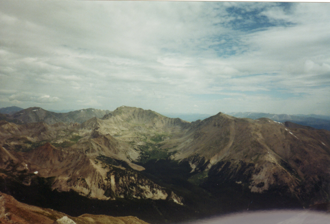
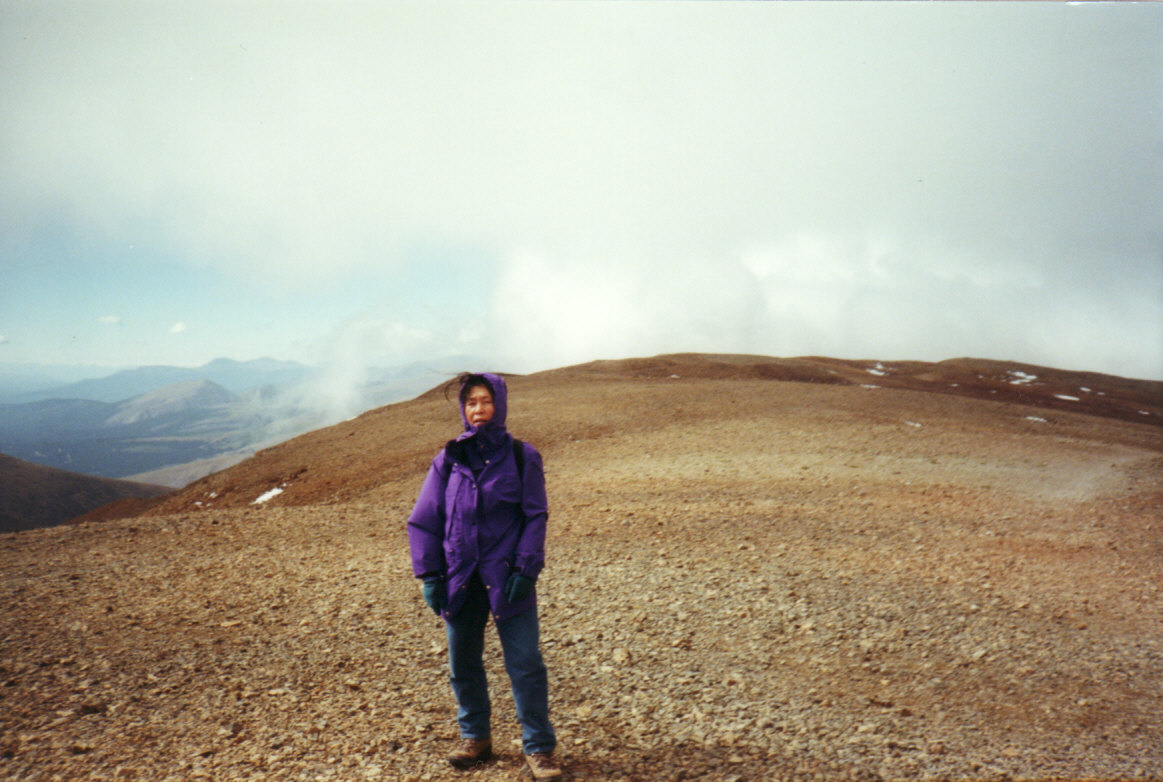
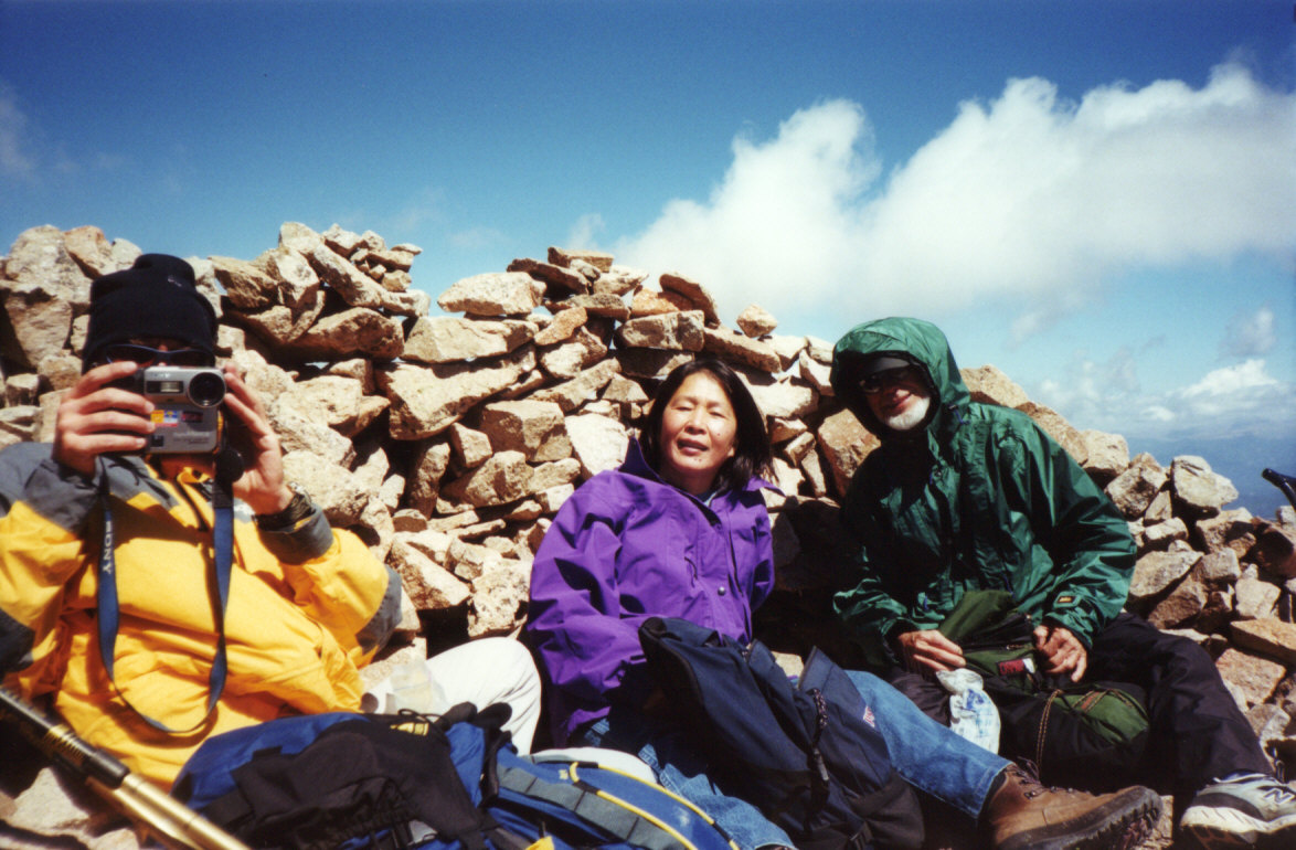
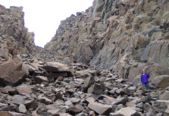
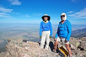
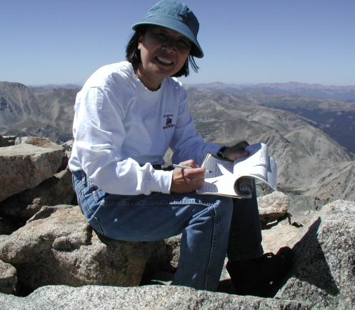
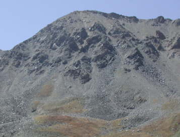
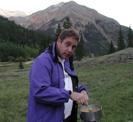
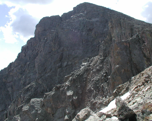
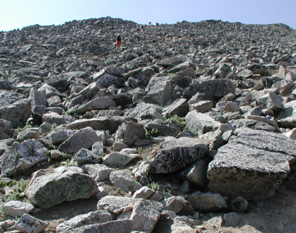
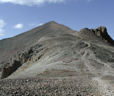
This is the highest mountain in Colorado and class 1 is the easiest trail classcification. Total distance is 9 miles and I spend 4hrs for up and 2hrs 45minutes for down. My hiking time does include the time to take a lot of pictures. On the summit, I don't know why but man's underware was displayed. Do you know why?
|
|
| |
 |
|
 |
|
 |
|
 |
|
 |
|
| |
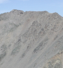
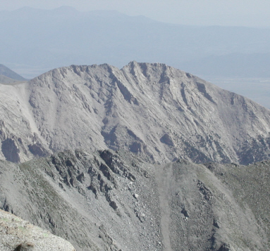
Over View |
|
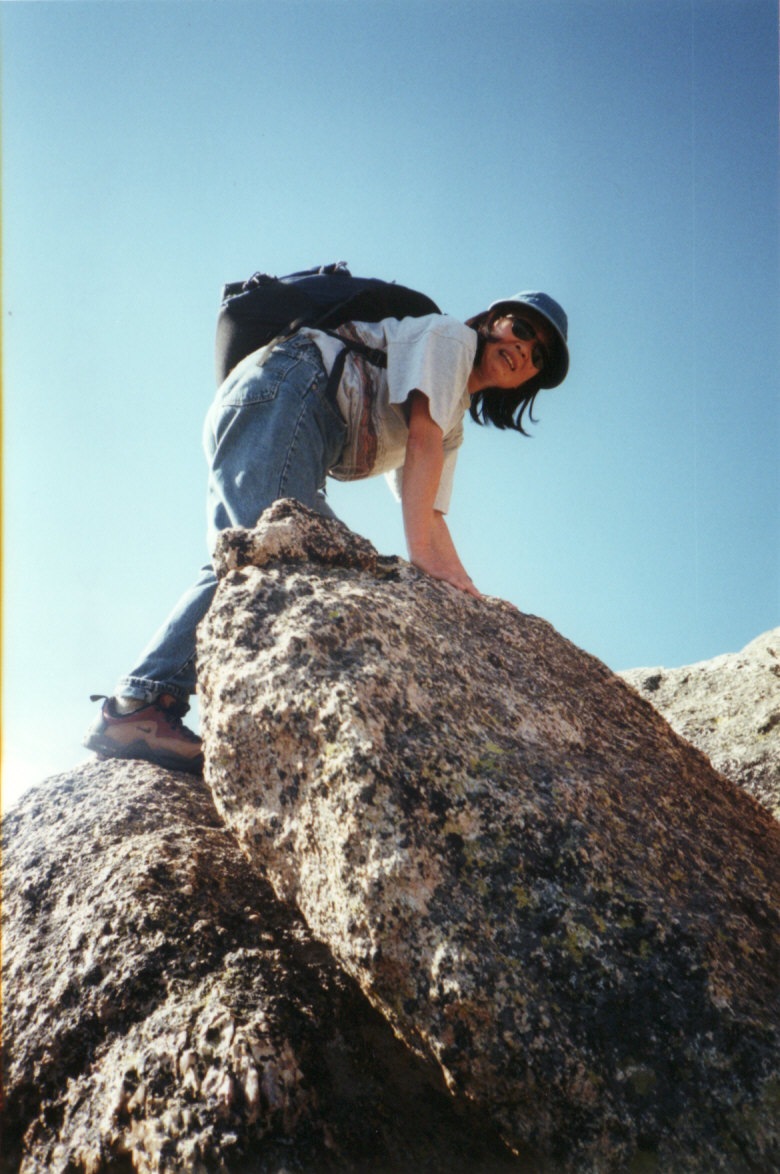
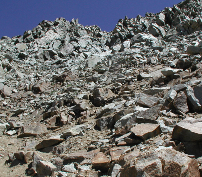
Closer Look |
|
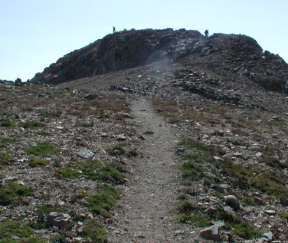
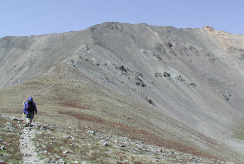
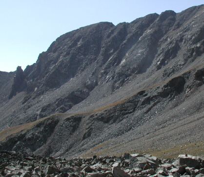
View from the trail |
|
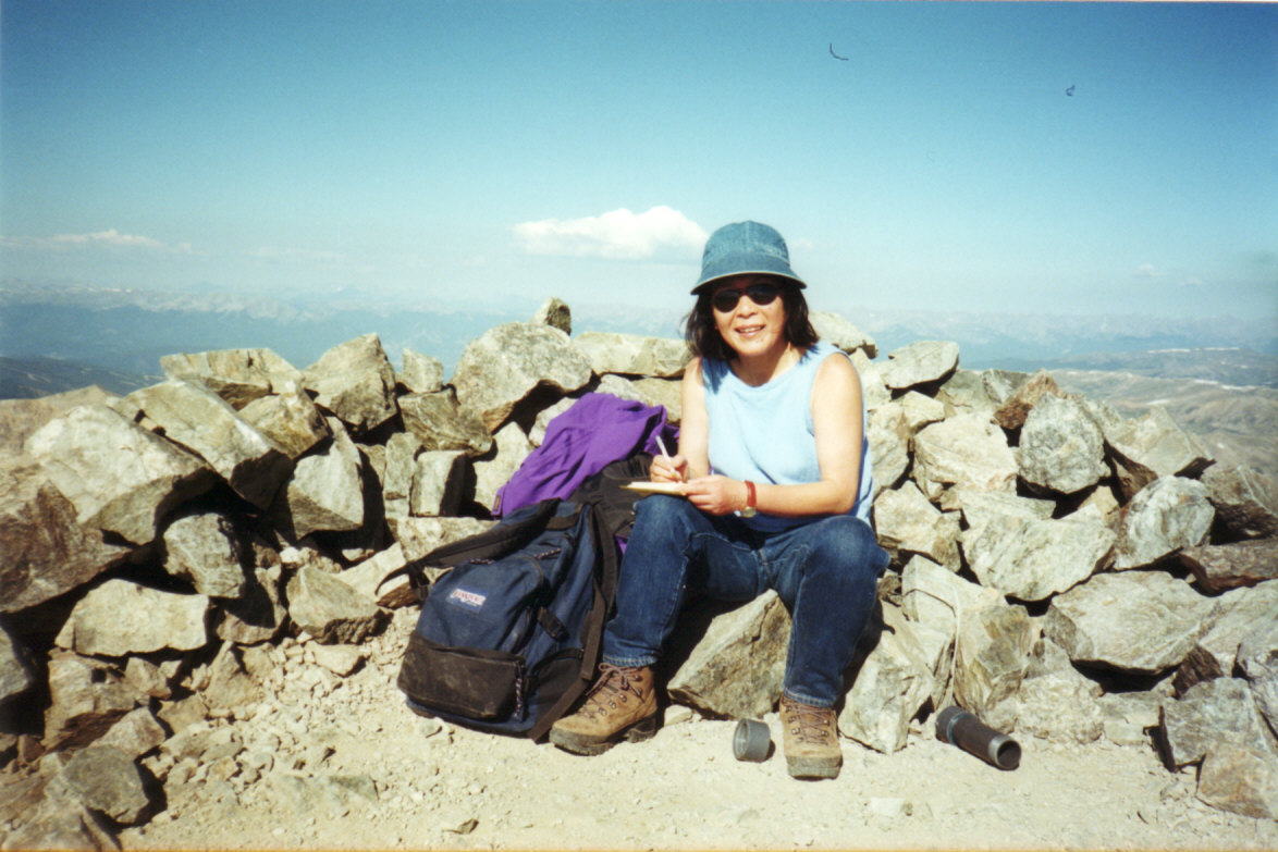
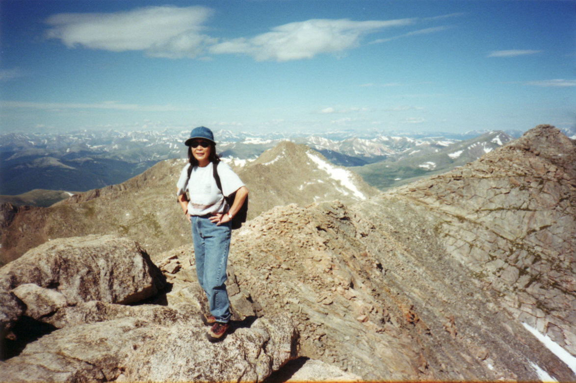
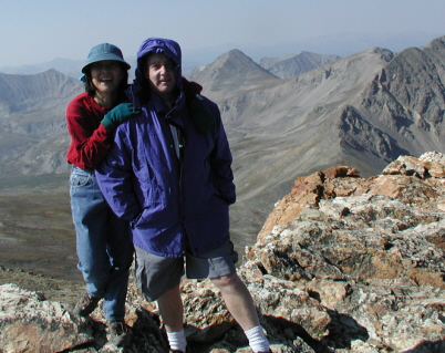
On the Summit |
|
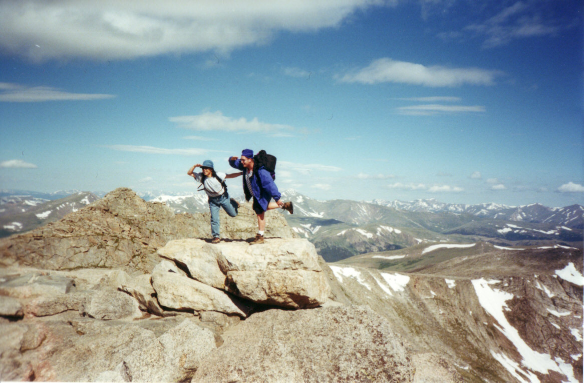
Displayed man's underware |
|
| |
|
|
|
|
|
|
|
|
|
|
| |
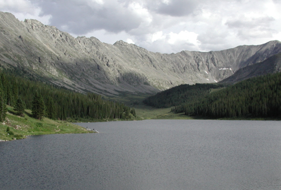
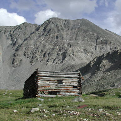
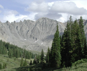
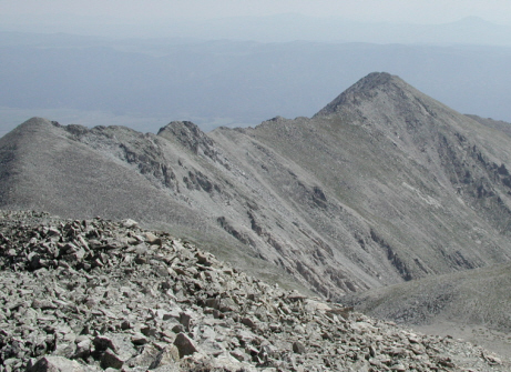
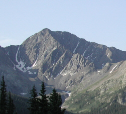
#2 Mt Massive - 14,421 ft - Class 2 - 8/11/01 |
|
| |
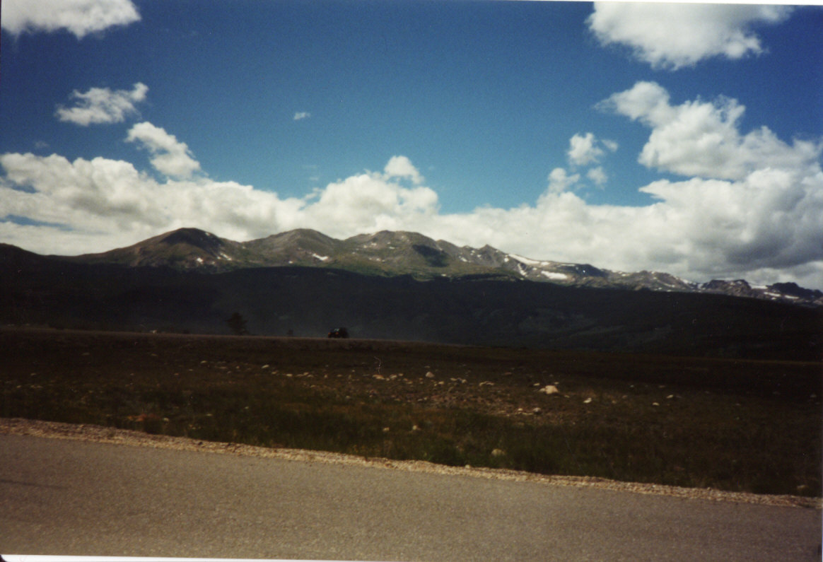
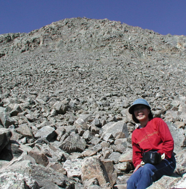
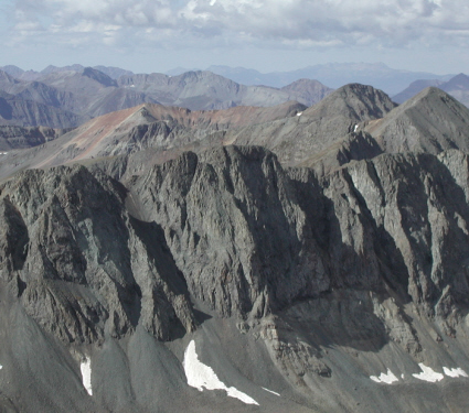
There are five summits over 14,000 ft for Massive mountain range, but officially count only the highest one. It is long trail, I started hiking at 5am. Many wildflowers and mushrooms were blooming and I was busy for taking pictures. |
|
| |
 |
|
 |
|
 |
|
 |
|
 |
|
| |
Over View |
|
Lake |
|
Old Cabin |
|
Massive Mountain Range |
|
View From the Summit |
|
| |
|
|
|
|
|
|
|
|
|
|
| |
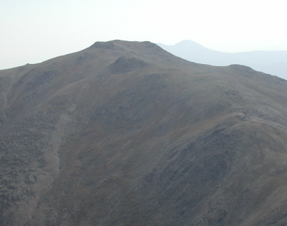
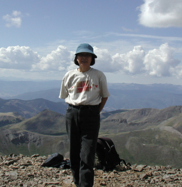
#3 Mt Harvard - 14,420 ft - Class 2 - 7/28/02 |
|
| |
I try to hike the Harvard and Columbia combination on the same day. Unfortunately I couldn't find the connection trail from the Harvard to Columbia route, and lost. I hiked west side of mountain for 13hrs straight to get back to the parking lot. During finding the trail to get back to the parking lot, I was uncomfotable to hike not on the trail but no energy to go back to hike up to the where I came. Since this unfortunate experience I am more carefull hiker than before.
|
|
| |
 |
|
 |
|
 |
|
 |
|
 |
|
| |
Over View |
|
Merge to Colorado Ttrail |
|
Closer Look |
|
View from the Summit |
|
Summit |
|
| |
|
|
|
|
|
|
|
|
|
|
| |
#4 La Plata Peak - 14,336 ft - Class 2 - 7/13/02 |
|
| |
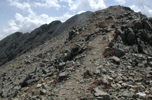
The trail head is not easy to find and small parking lot. 1/3 of top trail is steep and near the summit is rocky. |
|
| |
 |
|
 |
|
 |
|
 |
|
 |
|
| |
Over View |
|
Closer View |
|
Nice view along the trail |
|
Not too far from the Top |
|
Celebration Time |
|
| |
|
|
|
|
|
|
|
|
|
|
| |
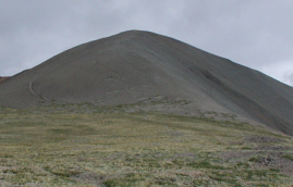
#5 Mt Lincoln - 14,286 ft - Class 2 - 8/19/00 |
|
| |
I completed three mountains, Mt Democrat, Mt Lincoln and Mt Bross, at the same day. It is manageable to hike three mountains in one day. Mt Cameron - 14,238ft - is only 157ft away from Mt Lincoln, and it's too close to not count for official 14ers.
|
|
| |
 |
|
 |
|
 |
|
 |
|
 |
|
| |
Over View |
|
Mt Cameron behind |
|
View from the Trail |
|
Trail to Bross |
|
On the Summit |
|
| |
|
|
|
|
|
|
|
|
|
|
| |
#6 Grays Peak - 14,270 ft - Class 1 - 8/6/00 |
|
| |
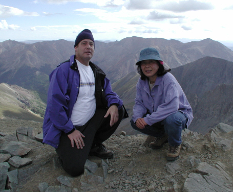
We hiked Grays Peak and Torreys Peak on the same day. These mountains are close to Devner and trail is well maintained. I think that the reasons so many people are hiking these mountains, just like zoo.
|
|
| |
 |
|
 |
|
 |
|
 |
|
 |
|
| |
Over View |
|
On the Summit |
|
view from the Summit |
|
Scott on the Summit |
|
Trail to Torreys Peak |
|
| |
|
|
|
|
|
|
|
|
|
|
| |
#7 Mt Antero - 14,269 ft - Class 2 - 7/28/01 |
|
| |
The trail for Mt Antero is not only the hikers, for 4WD and ATV, who are gem collectors. They are looking for aquamarine and topaz gems, and quartz crystals.
|
|
| |
 |
|
 |
|
 |
|
 |
|
 |
|
| |
Over View |
|
View from the trail |
|
Fond gems? |
|
On the Summit |
|
Summit's another view |
|
| |
|
|
|
|
|
|
|
|
|
|
| |
#8 Torreys Peak- 14,267 ft - Class 2 - 8/6/00 |
|
| |
Torreys Peak is not too far from the Grays Peak, we hiked both peaks on the same day. Lot of people on the Grays Peak but not on the Torreys Peak.
|
|
| |
 |
|
 |
|
 |
|
 |
|
 |
|
| |
Over View |
|
Trail to Grays Peak |
|
On the Summit |
|
Grays Peak behind |
|
Down from Torreys Summit |
|
| |
|
|
|
|
|
|
|
|
|
|
| |
#9 Quandary Peak - 14,265 ft - Class 1 - 8/12/00 |
|
| |
We had difficult time to find the trail head and not well marked parking lot, we parked side of the country road. The trail was easy and enjoyable views.
|
|
| |
 |
|
 |
|
 |
|
 |
|
|
|
| |
Over View |
|
View from the trail |
|
On the Summit |
|
On the Summit with Scott |
|
View From the Summit |
|
| |
|
|
|
|
|
|
|
|
|
|
| |
#10 Mt Evans - 14,264 ft - Class 2 - 7/1/00 |
|
| |
We started from the lake and hike up close to the chimney rocks/wall, Scott said he climbed this chimney wall long time ago. We have to climb up the large rocks to get the summit, which is near the summit parking lot.
|
|
| |
 |
|
 |
|
 |
|
 |
|
 |
|
| |
Climbing the rocks |
|
Lake view |
|
On the Summit |
|
We made it |
|
Traditional Style? |
|
| |
|
|
|
|
|
|
|
|
|
|
| |
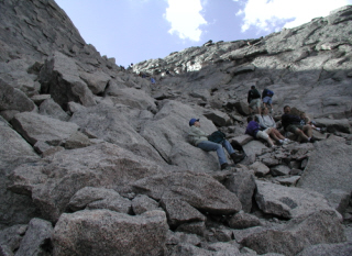
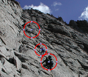
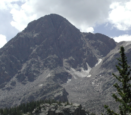
#11 Longs Peak - 14,255 ft - Class 3 - 8/31/02 |
|
| |
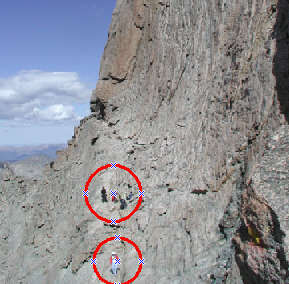
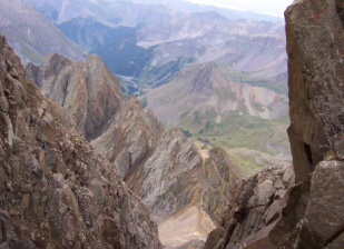
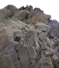
This trail is long one. We started at 3am, mid of night, using headlamps to hike. When we got at Boulder field, sunrise just started. Rocks, rocks everywhere rocks, this trail is only for good weather. Many people are hiking, least 200 people on this day, so that nothing worry about to miss the trail. At the last steep wall, straight up to me, it's climbing not hiking that was most scary parts of this trail. Lucky enough that I got support from Scott to complete to climb up this final wall. |
|
| |
 |
|
 |
|
 |
|
 |
|
 |
|
| |
Over View |
|
Boulder Field & Key Hole |
|
Very Narrow Trail
Circles indicate hikers
|
|
Steep Trail |
|
Last Wall to Climb
Circles indicate people are climbing up |
|
| |
|
|
|
|
|
|
|
|
|
|
| |
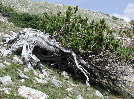
#12 Mt Shavano - 14,229 ft - Class 2 - 8/18/01 |
|
| |
The starting point of the trail is the Colorado trail. We hiked both Mt. Shavano and Tabeguache Peak at the same day. We spend total 10 hrs for one round trip. First we hiked to Shavano then hike to Tabeguache, where I spend more time to come back from Tabeguache to Shavano because I was very tired at that time.
|
|
| |
 |
|
 |
|
 |
|
 |
|
 |
|
| |
Isn't a nice picture? |
|
Very old beautiful tree |
|
Over View |
|
Nice view from the trail |
|
Another nice view |
|
| |
|
|
|
|
|
|
|
|
|
|
| |
#13 Mt Belford- 14,197 ft - Class 1 - 8/17/02 |
|
| |
We hiked Mt. Belford and Mt. Oxford at the same day. First we hiked to Belford and Oxford, then came back from Oxfor to Belford. We spend 4hrs to get Belford, 1.5 hrs for round trip from Belford to Oxford, and 3 hrs to get back to the parking lot.
|
|
| |
 |
|
 |
|
 |
|
 |
|
 |
|
| |
Over View |
|
Trail to Summit |
|
The Summit |
|
Trail to Oxford |
|
View of Oxford |
|
| |
|
|
|
|
|
|
|
|
|
|
| |
#14 Mt Princeton - 14,197 ft - Class 2 - 7/14/01 |
|
| |
To get to the parking lot was charangeable, I don't think I can drive to the parking lot. Fortunately Scott drives up to the radio tower and found a parking space. There is not enough parking space and road is very nerrow all the way.
|
|
| |
 |
|
 |
|
 |
|
 |
|
 |
|
| |
Over View |
|
View from the trail |
|
Trail - Rocks everywhere |
|
On the Summit |
|
Rocky Summit |
|
| |
|
|
|
|
|
|
|
|
|
|
| |
#15 Mt Yale - 14,196 ft - Class 2 - 7/21/01 -no digital photos available |
|
| |
Sliding down big chunk of rocks at each steps just below the peak was not easy to hike up that a process of testing you ability to climb to the peak or not. I wanted to quit to hike that kind condition, which was not my kind trail, but I hiked one step at a time and finally I made it. .
|
|
| |
|
|
|
|
|
|
|
|
|
|
| |
|
|
|
|
|
|
|
|
|
|
| |
#16 Mt Bross - 14,172 ft - Class 2 - 8/19/00 |
|
| |
Mt Bross, Pikes Peak, Mt Evans are we can drive up to the summit without hike, but that doesn't count. We got off the car and hiked on the trail to get the summit.
|
|
| |
 |
|
 |
|
 |
|
 |
|
 |
|
| |
Over View |
|
On the way to Bross |
|
View from the trail |
|
Another View from the trail |
|
On the Summit |
|
| |
|
|
|
|
|
|
|
|
|
|
| |
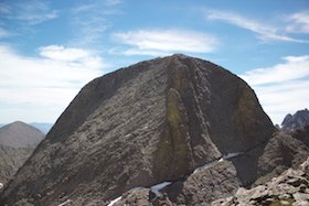
#17 Kit Carson Peak - 14,165 ft - Class 3 - 7/5/14 |
|
| |
We had camp at the Willow Lake and hike up to the Challenger Point then got to the Kit Carson route.
|
|
| |
 |
|
 |
|
 |
|
 |
|
 |
|
| |
The summit |
|
Another view of the summit |
|
From top of the summit |
|
Just above the Willow Lake |
|
Just above the Willow Lake |
|
| |
|
|
|
|
|
|
|
|
|
|
| |
#18 Tabeguache Peak - 14,155 ft - Class 2 - 8/18/01 |
|
| |
We don't ponounce "g" for Tabeguache and ponounce "u" for like "woo" and "che" for "she", so that over all it ponounces like "Tabewooashe" It was long hike; we spend about 10 hrs of hike for both Shavano and Tabeguache at one day.
|
|
| |
 |
|
 |
|
 |
|
 |
|
 |
|
| |
Over View |
|
Nice view from the trail |
|
Summit View |
|
On the Summit |
|
Tabeguache from Shavano |
|
| |
|
|
|
|
|
|
|
|
|
|
| |
#19 Mt Oxford - 14,153 ft - Class 2 - 8/17/02 |
|
| |
Very clear trail from Mt Belford to Mt Oxford and only 1.2 miles apart. We hiked on the ridge between two mountains.
|
|
| |
 |
|
 |
|
 |
|
 |
|
 |
|
| |
Over View |
|
Near the Summit |
|
Summit Area |
|
Way back to Belford |
|
Belford View from Oxford |
|
| |
|
|
|
|
|
|
|
|
|
|
| |
#20 Mt Sneffels - 14,150 ft - Class 2 - 9/3/03 |
|
| |
The Yankee Boy Basin trail is another gorgeous place to see many beautiful waterfalls, which is the trail we hiked. Just before we reach the summit, snow started to falling and little below was rain. Winter comes early on the top of mountain. |
|
| |
 |
|
 |
|
 |
|
 |
|
|
|
| |
Over View |
|
Rocks after rocks |
|
View from the trail |
|
Just before Summit |
|
View from the Summit |
|
| |
|
|
|
|
|
|
|
|
|
|
| |
#21 Mt Democrat - 14,148 ft - Class 2 - 8/19/00 |
|
| |
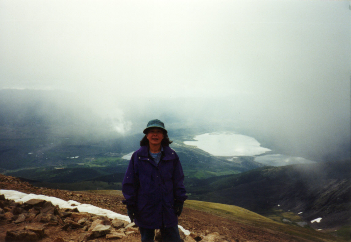
Mountain weather change quickly, when started it was ok weather, where reached at the summit I think I was in the cloud, which means it was bad weather.
|
|
| |
 |
|
 |
|
 |
|
 |
|
 |
|
| |
Over View |
|
View from the trail |
|
View from the trail |
|
Take a break by the Old Cabin |
|
On the Summit, I was in the cloud |
|
| |
|
|
|
|
|
|
|
|
|
|
| |
#22 Pikes Peak - 14,110 ft - Class 2 - 10/8/00 -no digital photos available |
|
| |
We parked a car at the Devil's Playground Trailhead then hike up mainly on the large rocks. When coming down from the summit, we start to walk on the road and road patrol told us it's illegal to walk on the road, so that we hike down the rocky trail. |
|
| |
|
|
|
|
|
|
|
|
|
|
| |
|
|
|
|
|
|
|
|
|
|
| |
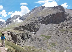
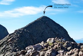
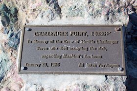
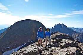
#23 Challenger Point - 14,087 ft - Class 2 - 7/5/14 |
|
| |
We had approached from west side, but couldn't find the trail. And I tried from the Mount Harvard connection trail, but I lost. This is the third try and finally succeeds. I was uncomfortable at the rock slide area at near the summit to hike down. It was steep and rocks slide down every my steps, glad no one there to get hurt.
|
|
| |
 |
|
 |
|
 |
|
 |
|
 |
|
| |
Over View |
|
Plate |
|
On the way to peak |
|
Kit Carson Peak back |
|
Summit with Harlan Stockman |
|
| |
|
|
|
|
|
|
|
|
|
|
| |
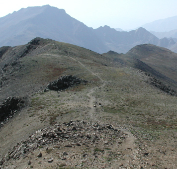
#24 Mt Columbia - 14,073 ft - Class 2 - 8/11/02 |
|
| |
We had approached from west side, but couldn't find the trail. And I tried from the Mount Harvard connection trail, but I lost. This is the third try and finally succeeds. I was uncomfortable at the rock slide area at near the summit to hike down. It was steep and rocks slide down every my steps, glad no one there to get hurt.
|
|
| |
 |
|
 |
|
 |
|
 |
|
 |
|
| |
Over View |
|
Waterfall |
|
Rock Slide Area |
|
False Summit |
|
Summit - sign the sheet |
|
| |
|
|
|
|
|
|
|
|
|
|
| |
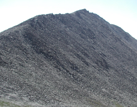
#25 Missouri Mountain - 14,067 ft - Class 2 - 8/27/02 |
|
| |
We spend 5hrs for hike up to summit and 3hrs to coming down. Some places are rocky but manageable for average hiker like me. |
|
| |
 |
|
 |
|
 |
|
 |
|
 |
|
| |
Over View |
|
Closer Look |
|
Break Time |
|
Almost Top |
|
View From the Summit |
|
| |
|
|
|
|
|
|
|
|
|
|
| |
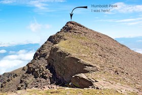
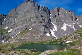
#26 Humboldt Peak - 14,064 ft - Class 4 - 7/8/14 |
|
| |
North side of just below the summit was class 4 wall to climb up that I did it, but you don't need to just follow the ridge trail that class 2.
|
|
| |
 |
|
 |
|
 |
|
 |
|
 |
|
| |
The summit view |
|
Near the lake view |
|
near the lake view |
|
From the summit |
|
View from near the summit |
|
| |
|
|
|
|
|
|
|
|
|
|
| |
#27 Mt Bierstadt - 14,060 ft - Class 2 - 6/30/01 |
|
| |
Many wooden bridges at the beginning of the trail, without the bridges we have to hike in the mud. From time-to-time, I have to face the pack of snow that was icy and soggy, not easy to hike up or down.
|
|
| |
 |
|
 |
|
 |
|
 |
|
 |
|
| |
Trail Head |
|
Over View |
|
Wooden Bridges |
|
Lake |
|
On the Summit |
|
| |
|
|
|
|
|
|
|
|
|
|
| |
#28 Handies Peak - 14,048 ft - Class 2 - 9/1/01 |
|
| |
Relatively easy trail, and views are spectacular. Addition to I enjoyed many wild flowers. We spend only 2hr 15min to reach the summit. |
|
| |
 |
|
 |
|
 |
|
 |
|
 |
|
| |
View from the trail |
|
Another View |
|
More View |
|
On the Summit |
|
Gorgeous View |
|
| |
|
|
|
|
|
|
|
|
|
|
| |
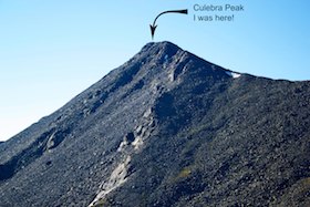
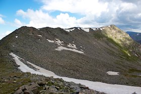
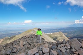
#29 Culebra Peak - 14,047 ft - Class 2 - 7/11/14 |
|
| |
This peak was everyone's dream one time to climb because old owner didn't anyone to trespassing this property. New owner let us in but charges $150 to climb.
|
|
| |
 |
|
 |
|
 |
|
 |
|
 |
|
| |
The summit view |
|
Huge cairn |
|
View from the trail |
|
Another View from the trail |
|
On the Summit |
|
| |
|
|
|
|
|
|
|
|
|
|
| |
#30 Mt Sherman - 14,036 ft - Class 2 - 7/7/01 |
|
| |
We started very early morning and went Mt Sheridan, 13,748fit, by mistake. When reached the summit of Sheridan, no-one around there that unlikely for 14ers. We figured out that we made mistake, after that we hike up to the destination of the Mt Sherman. So that we hiked two mountains.
|
|
| |
 |
|
 |
|
 |
|
 |
|
 |
|
| |
Over View |
|
On the trail |
|
On the Summit with Scott |
|
On the Summit |
|
Old Cabin |
|
| |
|
|
|
|
|
|
|
|
|
|
| |
#31 Redcloud Peak - 14,017 ft - Class 2 - 9/1/01 |
|
| |
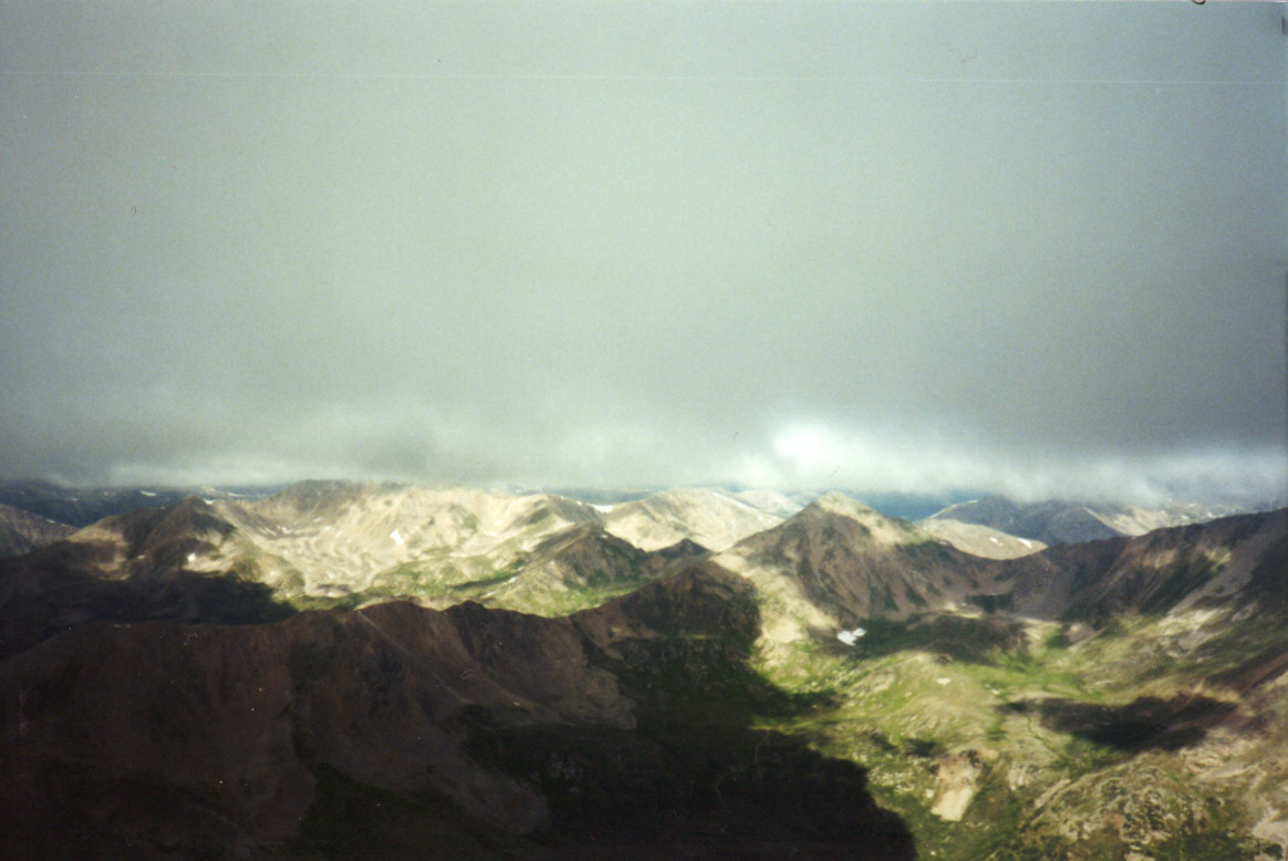
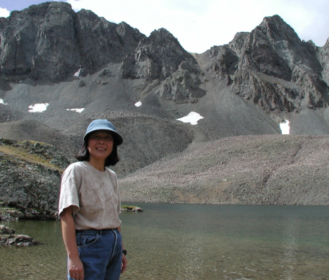
We hiked both Redcloud Peak and Sunshine Peak combination at the same day. The summit of the Redclud Peak dirt is really red color. From Redcloud to Sunshine is less than one hour to get there.
|
|
| |
 |
|
 |
|
 |
|
 |
|
 |
|
| |
Preparing Breakfast |
|
Over View |
|
Red Color Summit |
|
Pointing Sunshine Peak |
|
Trail to Sunshine Peak |
|
| |
|
|
|
|
|
|
|
|
|
|
| |
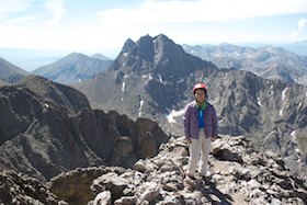
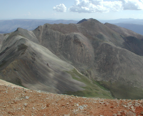
#32 Wilson Peak - 14,017 ft - Class 3 - 9/01/03 |
|
| |
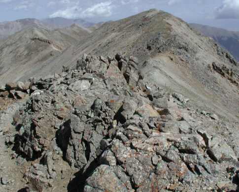
Definitely need a helmet for this trail especially just below the summit of the final wall. Possible to hit your head with rocks by someone above you who are climbing the wall. I am not climber at all; Scott who has no problem for any rock climbing. He insisted me that I can climb. I couldn't do it without his support; he stays couple steps behind me for entire climbing process. I am glad that I did it and have an extraordinary memory from this experience Thanks Scott. |
|
| |
 |
|
 |
|
 |
|
 |
|
 |
|
| |
Over View |
|
Closer Look |
|
View from the summit
View of the Wilson Mountain 14,246 ft |
|
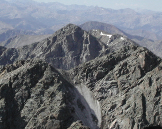
4 people are climing up for the final wall |
|
Summit View |
|
| |
|
|
|
|
|
|
|
|
|
|
| |
#33 San Luis Peak - 14,014 ft - Class 1 - 7/20/02 |
|
| |
If weather is permit, this is relatively easy 14ers to hike; unfortunately we had rain at the first try. At the second time, I try myself and completed. This is very quiet trail compare to another 14ers trails, I saw only handful people. |
|
| |
 |
|
 |
|
 |
|
 |
|
 |
|
| |
Over View |
|
Closer Look |
|
Nice View |
|
Different Vview |
|
I can reach the clouds |
|
| |
|
|
|
|
|
|
|
|
|
|
| |
#34 Mount of the Holy Cross - 14,005 ft - Class 2 - 8/25/01 |
|
| |
We have to hike two mountains, where second mountain is the Mt Holy Cross. It was very long hike, we started at 4:30am. We found many mushrooms and mountain flowers near the trail. |
|
| |
 |
|
 |
|
 |
|
 |
|
 |
|
| |
Over View |
|
Closer Look |
|
Summit View |
|
Almost Top |
|
Payoff Time |
|
| |
|
|
|
|
|
|
|
|
|
|
| |
#35 Huron Peak - 14,003 ft - Class 2 - 6/29/02 |
|
| |
The trail is narrow and lot of stairs and flies. Also I fond many wild flowers at the wildness boundary area. |
|
| |
 |
|
 |
|
 |
|
 |
|
 |
|
| |
Over View |
|
Closer Look |
|
Nice View from the Trail |
|
Endless Beauty |
|
Near the Summit |
|
| |
|
|
|
|
|
|
|
|
|
|
| |
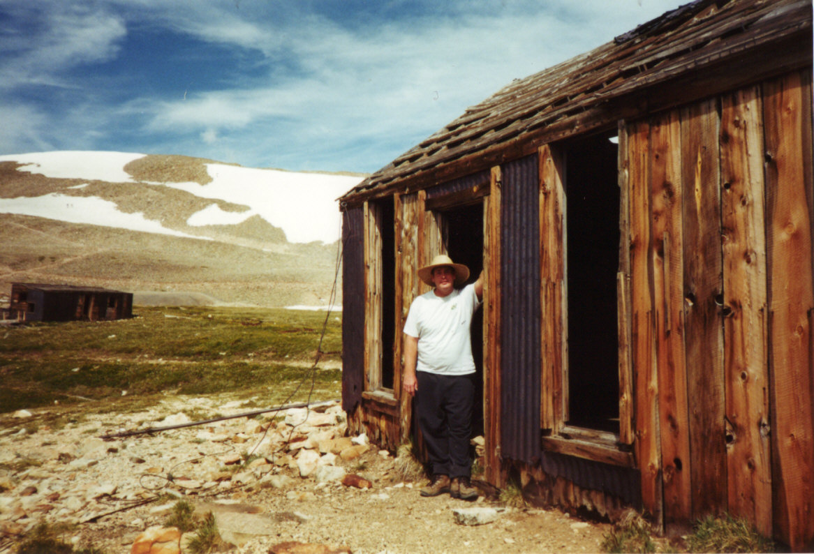
#36 Sunshine Peak - 14,001 ft - Class 2 - 9/2/01 |
|
| |
We hiked the Redcloud-Sunshine Saddle to get Sunshine, which descend and ascend to reach the summit. The trail is very clear until near the summit. After the trail is not clealy marked, we can hike anyway we want to get the summit. |
|
| |
 |
|
 |
|
 |
|
 |
|
|
|
| |
Old Cabin |
|
On the Summit |
|
Trail to Redcloud Peak |
|
Close to Redcloud Summit |
|
Color Variation |
|
| |
|
|
|
|
|
|
|
|
|
|
| ~~~~~~~~~~~~~~~~~~~~~~~~~~~~~~~~~~~~~~~~~~~~~~~~~~~~~~~~~~~~~~~~~~ |
|
Home |
Web Dev |
database |
Matsutake |
North America |
Calligraphy |
List |
Hiking |
Memoirs |
Contact |
| |